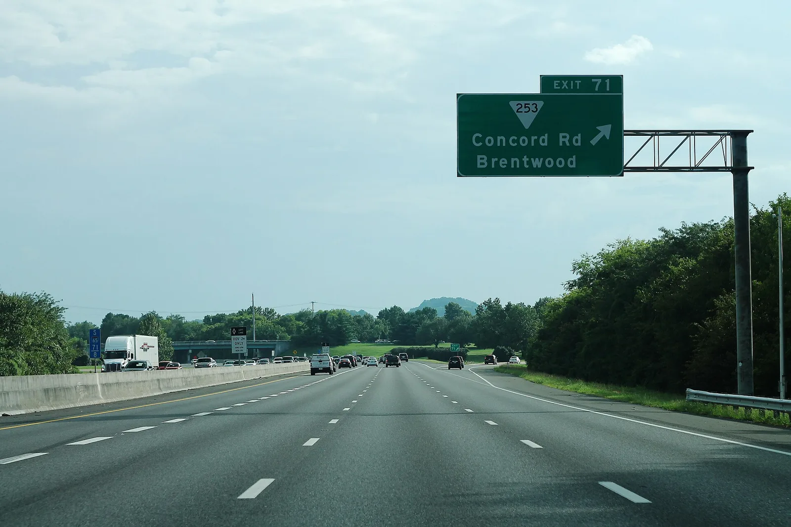
Brentwood's I-65 exits run from Old Hickory Boulevard (74) to Moores Lane (69). No WeGo bus stops in the city; the nearest commuter bus leaves Franklin.
Last checked Oct. 18, 2026. Updated Oct. 18, 2026. Live traffic: TDOT SmartWay or dial 511. City streets and signals: Brentwood Public Works, 615-371-0080. Bus schedules come from WeGo Public Transit’s published schedule data, current Oct. 4, 2026, to Jan. 2, 2027.
Brentwood is built around the car. The city sits on I-65 about 12 miles south of downtown Nashville, and 90% of its land is zoned for homes at one house per acre, according to the city’s history page. There is no rail or local bus service inside the city.
Who to call
- Live traffic and road closures: 511, or smartway.tn.gov
- Potholes or signals on I-65 and state routes: TDOT, 833-TDOTFIX
- City streets, signals and streetlights: Brentwood Public Works, 615-371-0080
- WeGo Public Transit customer care: 615-862-5950
- Nashville International Airport parking: 615-275-1045
Main roads and I-65 exits
The Tennessee Department of Transportation runs I-65 and the numbered state routes. The city builds and maintains the rest. Brentwood’s interstate exits, north to south:
| Exit | Road |
|---|---|
| 74 | Old Hickory Boulevard (SR 254) |
| 71 | Concord Road (SR 253) |
| 69 | Moores Lane (SR 441) |
Cool Springs Boulevard, Exit 68, is the next exit south, toward Franklin.
Off the interstate, Franklin Road (U.S. 31) runs north-south on the west side of I-65, Wilson Pike (SR 252) on the east side, and Concord Road crosses the city east to west. The Moores Lane interchange opened in the mid-1970s and the Concord Road interchange in the late 1980s, the city says.
Current lane closures, including TDOT’s nightly I-65 resurfacing through the end of 2026, are in our road construction and closures guide, refreshed weekly. The city also posts live traffic cameras.
Buses and park-and-ride
WeGo Public Transit, Nashville’s transit agency, has no bus stop inside Brentwood. Two routes come closest:
- Route 95 Spring Hill-Franklin, a weekday commuter express. In the morning, buses leave the Williamson County Ag Expo Park park-and-ride in Franklin, about 10 miles south of the city center, between 6:05 and 6:57 a.m. for downtown Nashville, with some trips via the Vanderbilt medical center area. Return trips leave downtown between 3:30 and 4:48 p.m.
- Route 52 Nolensville Pike reaches Nolensville Pike and Old Hickory Boulevard in Nashville, just outside the city’s northeast corner, and runs into downtown.
WeGo’s schedule data also lists event-day trips from the Cool Springs Park & Ride on some dates. Plan any trip with WeGo’s trip planner at wegotransit.com or call 615-862-5950.
Getting to the airport
Nashville International Airport (BNA) is the nearest airport with airline service, about 11 miles northeast of the city center in a straight line. Most Brentwood drivers reach it by I-65 north toward Nashville. BNA lists garage, surface lot and valet options on its parking page; parking questions go to 615-275-1045. WeGo’s route 18 Airport serves the terminal from downtown Nashville, so a transit trip from Brentwood means a transfer downtown.
Bikes, trails and walking
Brentwood’s paved bikeway follows the Little Harpeth River and links Crockett Park, River Park, Primm Park and Concord Park, with other paths through Tower Park and the Maryland Farms Greenway. The city opened Middle Tennessee’s first bikeway network in 1993, its timeline says. Maps and trail hours are in our parks and trails guide.
E-bike rules on park trails, from the city’s e-bike page:
- Class 1 and Class 2 e-bikes are allowed; Class 3 e-bikes are not.
- Low-speed four-wheeled vehicles, gas or electric, are not allowed.
- Stay under 15 mph, slow to 5 mph when passing, keep right and pass on the left.
I-65 is the big barrier for walkers and cyclists. A 2018 study for the city recommended a path under or over the interstate near Tower Park, but City Manager Kirk Bednar said then that costs above $5 million made it a project the city could not take on soon, according to the city’s bike and pedestrian planning page.
Parking
Brentwood has no traditional downtown, and the city’s website lists no parking meters, paid lots or public parking decks. Parking is in the lots of office parks such as Maryland Farms, shopping centers and the city’s parks.
Related guides: moving to Brentwood, who to call at City Hall and things to do this month.
Frequently asked questions
What are the I-65 exits for Brentwood, TN?
Exit 74 is Old Hickory Boulevard (State Route 254), Exit 71 is Concord Road (State Route 253) and Exit 69 is Moores Lane (State Route 441). Cool Springs Boulevard, Exit 68, is the next exit south.
Is there a bus from Brentwood to Nashville?
No WeGo bus stops inside Brentwood. The nearest weekday commuter bus is WeGo route 95, which leaves the Williamson County Ag Expo Park park-and-ride in Franklin for downtown Nashville each morning.
What is the closest airport to Brentwood, Tennessee?
Nashville International Airport (BNA), about 11 miles northeast of the city center in a straight line. BNA parking questions: 615-275-1045.
Are e-bikes allowed on Brentwood trails?
Class 1 and Class 2 e-bikes are allowed on park trails; Class 3 e-bikes are not. Riders must stay under 15 mph and slow to 5 mph when passing, the city says.
Is parking free in Brentwood?
The city’s website lists no parking meters or public parking decks. Parking is in the lots of offices, stores and city parks.
Have your say