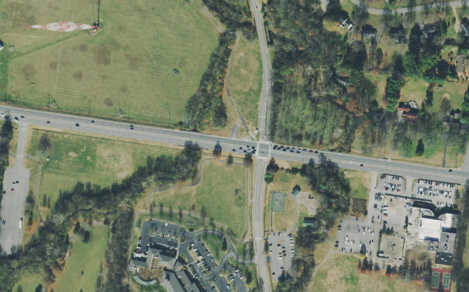
North-central Brentwood east of I-65, home to the library, River Park, Tower Park and Windy Hill Park, zoned mostly for Lipscomb and Brentwood High.
Last checked Oct. 18, 2026. Sources: the City of Brentwood’s subdivision and address layers, its Brentwood 2030 Plan and park pages; the 2023 Williamson County Schools boundaries on the City of Franklin’s planning map, checked with the WCS zoned school finder; the Tennessee Department of Education’s 2024-25 letter grades; Zillow Research; and OpenStreetMap.
East of I-65 and north of Crockett Park, Wilson Pike (State Route 252) runs north to Church Street East and Old Smyrna Road winds east toward Edmondson Pike. Between them are some of Brentwood’s larger subdivisions and most of the city’s public buildings. The city’s 2030 Plan calls the area east of the Concord Road interchange the Civic Activity Center, home to “the Library, YMCA, River Park, Tower Park, Martin Senior Center & Heritage Retirement Community.”
What this means for you
- Zoned high school: mostly Brentwood High (graded B for 2024-25), about 88% of addresses; the streets south of Concord Road near Crockett Road are zoned for Ravenwood High (A), in the 2023 boundaries.
- Home value: $1,220,331 in ZIP 37027 in September 2026, according to the Zillow Home Value Index.
- Nearest I-65 exit: exit 71 (Concord Road), about 2.1 miles by road.
Part of our Brentwood neighborhoods guide.
Where it is
For this guide the area runs east from I-65 to the Foxboro and Brentmeade streets short of Edmondson Pike, and from just south of Concord Road (State Route 253) north to Church Street East and the Davidson County line, with Wilson Pike and Old Smyrna Road through the middle. It is all in ZIP code 37027. The plan describes Old Smyrna Road as “a narrow two lane road with historic stone walls along some sections,” lists a project to realign it east of its 90-degree curves, and names Wilson Pike from Church Street to Concord Road among the roads with safety or design problems.
Homes
The city’s address map lists about 1,770 residential addresses here. By count the largest subdivisions are Brentmeade Estates (about 280), Carondelet (170), Annandale (169), part of Foxboro Estates (126), Concord Hunt (104) and Lansdowne (98), then Concord Green, Brentwood Estates, Hallbrook, Twin Springs, Brentwood Glen and Smyrna Road Homes. The Heritage retirement community, on Heritage Way, accounts for about 70 more addresses. OpenStreetMap names Hallbrook, Twin Springs Estates, Brentwood Estates and Cloverland Acres among its places here.
Schools
Zones are the 2023 board-approved Williamson County Schools boundaries, which matched the district’s live finder at each subdivision. Grades are each school’s overall letter grade on Tennessee’s 2024-25 state report card.
| Subdivisions | Elementary | Middle | High |
|---|---|---|---|
| Annandale, Carondelet, Brentwood Estates, Hallbrook, Twin Springs, Smyrna Road Homes | Lipscomb (A) | Brentwood (A) | Brentwood (B) |
| Brentmeade Estates, Lansdowne, Foxboro Estates | Edmondson (C) | Brentwood (A) | Brentwood (B) |
| Concord Hunt, Brentwood Glen, Indian Point | Crockett (A) | Woodland (A) | Ravenwood (A) |
By address, about 60% of the area is zoned for Lipscomb, 27% for Edmondson and 12% for Crockett. School addresses: Lipscomb Elementary, 8011 Concord Road, inside the area; Edmondson Elementary, 851 Edmondson Pike; Crockett Elementary, 9019 Crockett Road; Woodland Middle, 1500 Volunteer Parkway; Brentwood Middle and High, 5324 and 5304 Murray Lane; Ravenwood High, 1724 Wilson Pike. Check one address in the WCS zoned school finder. More in our schools guide.
Home values
The typical home value in ZIP code 37027 was $1,220,331 in September 2026, up 4.3% from $1,169,780 in September 2025, according to the Zillow Home Value Index. The index is a modeled typical value for the middle third of homes, not a sale price, and 37027 covers the whole city, so it is not a figure for this area alone. The City of Brentwood figure was $1,388,985, up 4.1%. Every home in the city pays the same 2025 property tax rate, $1.49 per $100 of assessed value, according to the Tennessee Comptroller. More in our home prices and property taxes guides.
Parks and trails
- River Park, 1100 Knox Valley Drive, across from the library: 46 acres with a two-mile bikeway and walking path along the Little Harpeth River linking Crockett Park and Concord Park, per the park page.
- Tower Park, 920 Heritage Way: 47 acres around the historic WSM broadcast tower, with walking and biking trails, fields and Miss Peggy’s Bark Park, open 8 a.m. to 10 p.m. The county’s Williamson County Sports Complex, with a pool and indoor tennis courts, is next door, according to the park page.
- Concord Park, on Concord Road across from the WSM tower: walking paths, bikeways and practice fields at one end of River Park, per the city.
- Windy Hill Park, Old Smyrna Road: a 52-acre passive park with a playground and picnic tables and no athletic fields. The city bought the land from the Sensing family in May 2020 for $5.2 million, and the historic Windy Hill house, built by Constantine Perkins Sneed after the War of 1812, stands on a high point off Old Smyrna Road, according to the park page.
The John P. Holt Brentwood Library is at 8109 Concord Road. More in our parks and trails guide.
Getting around
- Interstate: I-65 exit 71 (Concord Road) is about 2.1 miles by road from the middle of the area; exit 74 (Old Hickory Boulevard) is about 3.3 miles.
- Town Center: about 2.7 miles by road to Franklin Road at Church Street East.
- Airport: about 13.8 miles by road to Nashville International Airport (BNA).
- Trails and bus: the bikeway through River Park links the library with Crockett Park. WeGo Public Transit has no bus stop inside Brentwood; see our getting around guide.
Distances are measured on the OpenStreetMap road network with the OSRM routing engine from a home near the middle of the area; they are distances, not drive times.
Groceries and everyday stores
There is no supermarket inside the area. The nearest, from OpenStreetMap:
- Kroger, 210 Franklin Road.
- Walgreens, Franklin Road near Old Hickory Boulevard.
- Publix, 101 Creekside Crossing.
How we drew this area
The area is Brentwood east of I-65 and north of the Crockett Park neighborhoods, west of the Edmondson Pike subdivisions, taking in the Civic Activity Center the 2030 Plan defines, with the subdivisions on the city’s map, checked Oct. 18, 2026. Address counts and school shares come from the city’s address points and the 2023 WCS boundaries. Store locations are © OpenStreetMap contributors.
Frequently asked questions
What schools are Brentmeade and Annandale in Brentwood zoned for?
In the 2023 Williamson County Schools boundaries, Annandale is zoned for Lipscomb Elementary and Brentmeade for Edmondson Elementary; both go on to Brentwood Middle and Brentwood High. Concord Hunt and Brentwood Glen, south of Concord Road, are zoned for Crockett Elementary, Woodland Middle and Ravenwood High.
Where is Windy Hill Park in Brentwood?
On Old Smyrna Road between Wilson and Edmondson pikes. The 52-acre passive park has a custom playground and picnic tables and no athletic fields. The city bought the land from the Sensing family in May 2020 for $5.2 million.
What is in Brentwood’s Civic Activity Center?
The city’s 2030 Plan defines it as the area east of the Concord Road interchange on I-65, containing the library, the YMCA, River Park, Tower Park, the Martin Senior Center and the Heritage retirement community.
Is the Wilson Pike area a good place to live?
Here are the facts. The area has about 1,770 residential addresses, the library and four city parks, and is zoned mostly for Brentwood High, graded B for 2024-25; the typical home value in ZIP 37027 was $1,220,331 in September 2026, according to Zillow.
Have your say