Central Brentwood around Crockett Park, split almost evenly between the Lipscomb-Brentwood High and Crockett-Woodland-Ravenwood school zones.
Last checked Oct. 18, 2026. Sources: the City of Brentwood’s subdivision and address layers, its Brentwood 2030 Plan and park pages; the 2023 Williamson County Schools boundaries on the City of Franklin’s planning map, checked with the WCS zoned school finder; the federal NCES school directory; the Tennessee Department of Education’s 2024-25 letter grades; Zillow Research; and OpenStreetMap.
Crockett Park, home of the Fourth of July fireworks and the summer concert series, sits in the middle of Brentwood between Wilson Pike and Crockett Road, with Woodland Middle and Crockett Elementary beside it. The subdivisions around it hold about 1,580 residential addresses on the city’s map, and they split almost exactly in half between two school zones: the streets west of the park toward I-65 are zoned for Brentwood High, and the streets east and south for Ravenwood High.
What this means for you
- Zoned high school: about 51% of addresses are zoned for Brentwood High (graded B for 2024-25) and 49% for Ravenwood High (A), in the 2023 boundaries. Check the exact address.
- Home value: $1,220,331 in ZIP 37027 in September 2026, according to the Zillow Home Value Index.
- Nearest I-65 exit: exit 71 (Concord Road), about 2.2 miles by road; exit 69 (Moores Lane) is about 2.8.
Part of our Brentwood neighborhoods guide.
Where it is
For this guide the area runs from I-65 east past Wilson Pike and Crockett Road to the Liberty Downs and Hampton Reserve streets, and from just south of Concord Road (State Route 253) to the Brenthaven and Raintree Forest streets north of Moores Lane. It is all in ZIP code 37027. The Little Harpeth River and the city bikeway run along its west side. The city’s 2030 Plan names Crockett Road, from Concord Road to Wilson Pike, among the roads with safety or design problems, and notes that the Witherspoon subdivision’s trail system connects to Raintree Forest, Somerset and Oakhall and gives access to Crockett Park, Crockett Elementary and Woodland Middle.
Homes
By number of residential addresses on the city’s map, the largest subdivisions are Brenthaven (about 260 here, with more to the south), Raintree Forest (221), Indian Point (148), Parkside at Brenthaven (118), Brenthaven East (111), Witherspoon (92), Brentwood Meadows (87) and Somerset (78), then Liberty Downs, Concord Chase Estates, Crockett Hills and Crockett Cove.
Schools
Zones are the 2023 board-approved Williamson County Schools boundaries, which matched the district’s live finder at each subdivision. Grades are each school’s overall letter grade on Tennessee’s 2024-25 state report card.
| Subdivisions | Elementary | Middle | High |
|---|---|---|---|
| Brenthaven, Parkside at Brenthaven, Brenthaven East, Brentwood Meadows, Concord Chase Estates, Crockett Hills, Crockett Cove | Lipscomb (A) | Brentwood (A) | Brentwood (B) |
| Raintree Forest, Indian Point, Witherspoon, Somerset, Liberty Downs, Hampton Reserve | Crockett (A) | Woodland (A) | Ravenwood (A) |
Crockett Elementary, 9019 Crockett Road, had 733 students and Woodland Middle, 1500 Volunteer Parkway, had 957 in the federal NCES directory. Other addresses: Lipscomb Elementary, 8011 Concord Road; Brentwood Middle and High, 5324 and 5304 Murray Lane; Ravenwood High, 1724 Wilson Pike. Check one address in the WCS zoned school finder. More in our schools guide.
Home values
The typical home value in ZIP code 37027 was $1,220,331 in September 2026, up 4.3% from $1,169,780 in September 2025, according to the Zillow Home Value Index. The index is a modeled typical value for the middle third of homes, not a sale price, and 37027 covers the whole city, so it is not a figure for this area alone. The City of Brentwood figure was $1,388,985, up 4.1%. Every home in the city pays the same 2025 property tax rate, $1.49 per $100 of assessed value, according to the Tennessee Comptroller. More in our home prices and property taxes guides.
Parks and trails
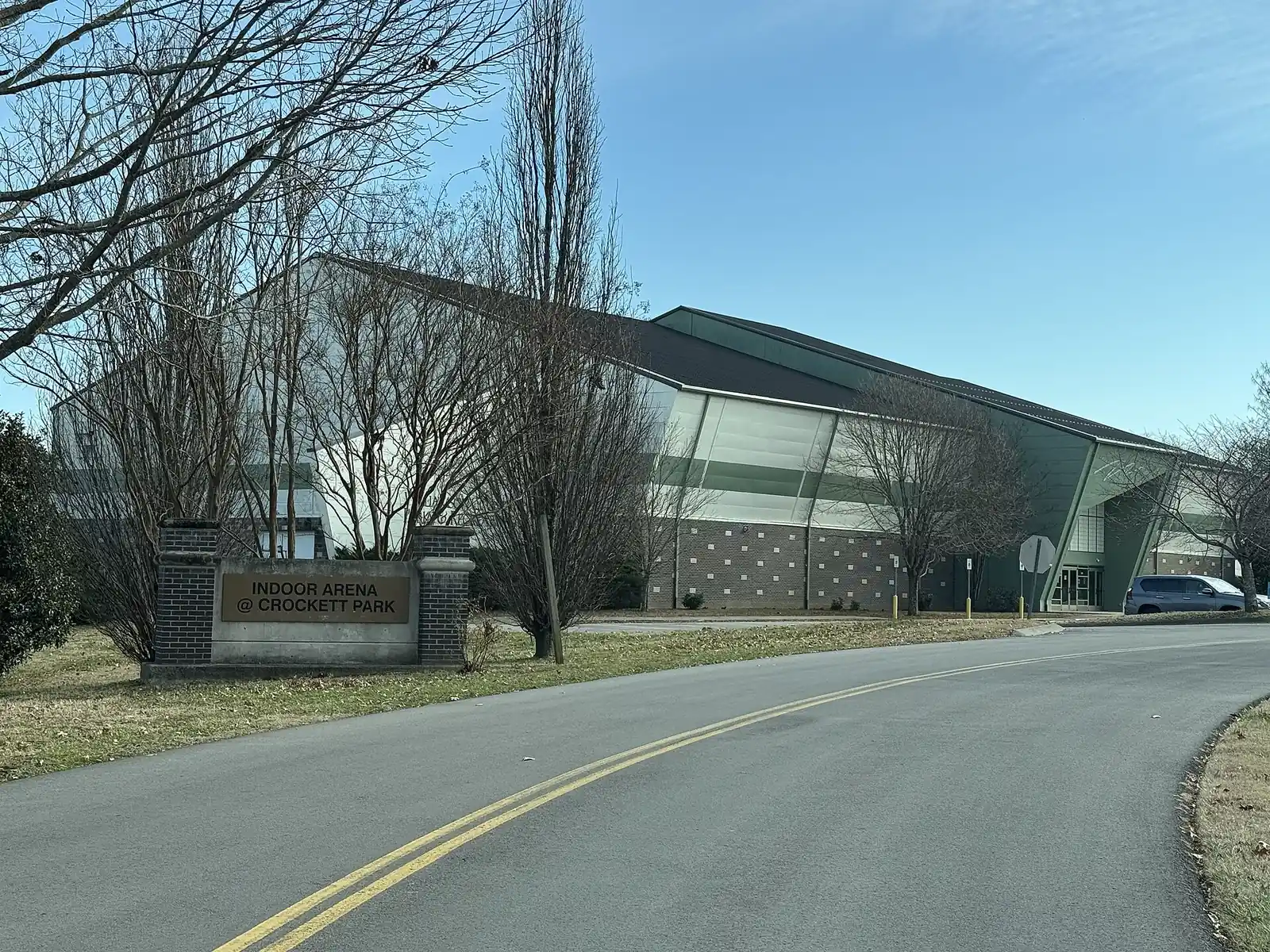
- Crockett Park, 1500 Volunteer Parkway: home of the historic Cool Springs House and the Eddy Arnold Amphitheater, with eight multipurpose fields (two lighted), eight lighted baseball and softball diamonds, seven lighted tennis courts, open meadows, a nature trail, paved walking paths and bikeways, the Brentwood Community Playground and an 18-hole disc golf course, open 6 a.m. to 10 p.m. An indoor arena inside the park is scheduled by Williamson County Parks and Recreation, 615-377-6530, according to the park page.
- River Park, 1100 Knox Valley Drive: its two-mile bikeway along the Little Harpeth River starts at Crockett Park and runs north to Concord Park, per the city.
More in our parks and trails and summer concert series guides.
Getting around
- Interstate: I-65 exit 71 (Concord Road) is about 2.2 miles by road from the middle of the area; exit 69 (Moores Lane) is about 2.8 miles.
- Town Center: about 4.2 miles by road to Franklin Road at Church Street East.
- Airport: about 15.8 miles by road to Nashville International Airport (BNA).
- Trails and bus: the bikeway links Crockett Park with River Park and the library. WeGo Public Transit has no bus stop inside Brentwood; see our getting around guide.
Distances are measured on the OpenStreetMap road network with the OSRM routing engine from a home near the middle of the area; they are distances, not drive times.
Groceries and everyday stores
There is no supermarket inside the area. The nearest, from OpenStreetMap:
- Publix, 8105 Moores Lane.
- ALDI, 1701 Mallory Lane.
- Walgreens, 9100 Carothers Parkway, and CVS Pharmacy, Carothers Parkway, just south in Franklin.
How we drew this area
The area is central Brentwood east of I-65 between the Concord Road neighborhoods and the Raintree and Ravenwood streets, centered on Crockett Park, with the subdivisions on the city’s map, checked Oct. 18, 2026. Address counts and school shares come from the city’s address points and the 2023 WCS boundaries. Store locations are © OpenStreetMap contributors.
Frequently asked questions
Is Brenthaven zoned for Brentwood High or Ravenwood High?
Brentwood High. In the 2023 Williamson County Schools boundaries, Brenthaven, Parkside at Brenthaven and Brenthaven East are zoned for Lipscomb Elementary, Brentwood Middle and Brentwood High. Raintree Forest, Indian Point and Witherspoon, across Crockett Road, are zoned for Crockett Elementary, Woodland Middle and Ravenwood High.
What is at Crockett Park in Brentwood?
Crockett Park, 1500 Volunteer Parkway, has the Eddy Arnold Amphitheater, the historic Cool Springs House, eight multipurpose fields, eight lighted baseball and softball diamonds, seven lighted tennis courts, a community playground, a nature trail, paved paths and an 18-hole disc golf course.
What schools are next to Crockett Park?
Woodland Middle, at 1500 Volunteer Parkway, and Crockett Elementary, at 9019 Crockett Road. Both were graded A on the 2024-25 state report card.
Is the Crockett Park area a good place to live?
Here are the facts. The area has about 1,580 residential addresses around Crockett Park, and is split between Brentwood High (graded B for 2024-25) and Ravenwood High (A); the typical home value in ZIP 37027 was $1,220,331 in September 2026, according to Zillow.
Have your say